


Seas Collection


Arabian Sea
Collected on Sept, 30 2014
by Dimple Udani
Collection Details:
-
 Collected at Girgaum Chowpatty, Mumbai India
 -
18° 57′ 3.6″ N, 72° 48′ 39.6″ E
-
Salinity: 46,874 mg/L
-
PH 6.59
-
Total Dissolved Solids: 59,256 mg/L,
-
Specific Conductance: 88,442 μs/cm

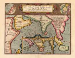
The Arabian Sea is a northwestern extension of the Indian Ocean, positioned between India, Oman, Pakistan and Yemen, and Cape Guardafui in far northeastern Somalia.
The sea connects with the Persian Gulf through the Gulf of Oman and the Strait of Hormuz. In the southwest, the Gulf of Aden connects it with the Red Sea.
The most significant ports in the Arabian Sea include Karachi, Pakistan, and Mumbai, India.
It has an estimated area of approximately 1,491,000 sq miles (3,862,000 sq km) and an estimated average depth of 8,970 feet (2,734 m). The southern border is a mapping opinion of Graphic Maps.
The Arabian Sea is connected to surrounding bodies of water by a series of gulfs and straits that provide a steady avenue into the sea. The largest and most notable of the gulfs which feed into the sea are the Gulf of Oman, which connects the Arabian Sea to the Persian Gulf and the Gulf of Aden that connects the Arabian Sea to the Red Sea. However, gulfs are not the only access point into the Arabian Sea, as two significant rivers drain into its borders. The Arabian is augmented by water flowing down the Indus and Narmada rivers, which are the principal means of access to the Arabian Sea.
The Arabian Sea is distinguished by its remarkably deep water level that is often maintained close to land masses. The deep water level is hypothesized to be one of the reasons that there are no significant island developments in the center of the Arabian Sea, despite the fact that islands are quite proliferate on the outer borders. The Arabian Sea floor, while far below the surface, exhibits a startling complexity akin to standard land formations. Perhaps most notable among the submarine features is the Maldive Ridge, which runs along the ocean floor from the Arabian Sea into the Indian Ocean. This ridge, which is essentially similar to a mountain range on land, eventually rises above the water level to become the Maldive Islands.
The Maldive Ridge, along with other sea floor formations in the Arabian Sea, are hypothesized to be the result of seismic activity roughly 50 million years ago. According to geologists, during this time period Asia collided with the subcontinent of India, forming the Arabian Sea and its unique underground ridges. After the initial collision of the two land masses, the Arabian Sea has been shaped by a variety of highly influential factors, including erosion from water currents. One of the deepest areas of the sea floor is where the Indus River meets the Arabian Ocean. In the place where the two bodies of water meet, a sharp canyon has been formed on the sea floor, as the forces of the incoming water sweep away the sandy bottom. Also as a result of this erosion, the Indus River carries the sediment further into the sea, eventually depositing the excess into ridges or other formations
Girgaon Chaupati', commonly known as just Chaupati (pronounced as chow-patty), is one of the most famous public beaches adjoining Marine Drive in the Girgaon area of Mumbai, India. The beach is famous for Ganesh Chaturthi celebrations when hundreds of people from all over Mumbai come to immerse the idols of Lord Ganapati in the Arabian Sea. It is also one of the many places in the city where the Ramlila is performed on a stage every year. An effigy of Ravan, that is erected on the sand, is burnt by the end of the 10-day performance. One can find several bhelpuri, panipuri, ragda patties and pav bhaji vendors on the beach.
Photos